
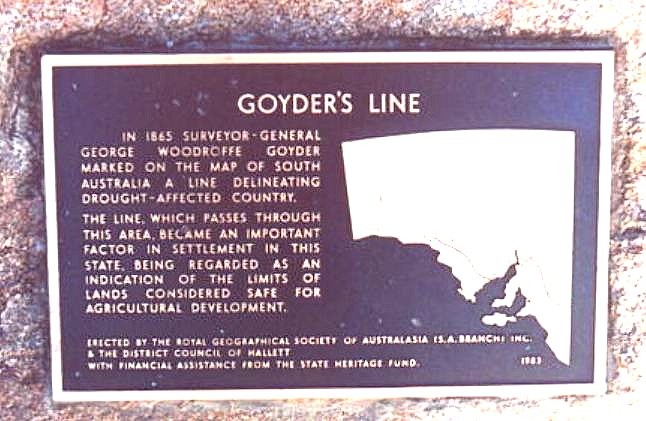
In the middle of the great 1860s drought, George Woodroffe Goyder, Surveyor General, was sent out to ‘lay down as nearly as practicable, the line of demarcation between the portion of the state where rainfall has extended and where the drought prevails’ (quoted in Mincham 1983:111).
Goyder used the vegetation zones as guides for rainfall zones. Saltbush was the main marker.
The line Goyder drew is a rule of thumb for land use. Land south of the line is generally suitable for growing crops. Land above the line is generally suitable for grazing – not crops. The line which passes through this area became an important factor in settlement in this State.
With a run of excellent seasons in the early 1870’s and a scarcity of agricultural land available, locals agitated for closer settlement north of Goyder’s Line by abolishing the deferred line and throwing all the country open for selection. The Government yielded to public pressure and abandoned the line and by September 1875 the Hundred of Willochra was opened for selection. Other hundreds in the area were taken up in quick succession and by 1877 much of the land was under crop.